Gulf Shores AL Condos for Sale
Labeled Aerial Image Search
Other Popular Searches
 |
 |
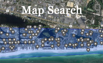 |
| Price Search | Search by Thumbnails | Map Search |
The map below makes finding condos in specific areas or knowing which condos are near each other easy. This image depicts the West Beach area of Gulf Shores AL area just West of the Hangout and public beach in downtown Gulf Shores, AL. Listed below the image are links to each of the condos labeled on the map. Click the link to view current listings in that particular Gulf Shores condo.

| Sandpiper | Caribbean | Gulf Village | Gulf Tower |
| Legacy | Crystal Tower | Edgewater | Edgewater West |
| Tropical Winds | Surfside Shores | Westwind | Ocean House |
| Crystal Shores | Crystal Shores West | Oceania |
East Beach Area of downtown Gulf Shores AL

| Colonnades | Gulf House | Whaler | Island Shores |
| Lighthouse | Island Sunrise | Boardwalk | Seawind |
| San Carlos | Castaways | Regatta | Phoenix All Suites |
West Beach area of downtown Gulf Shores, AL.
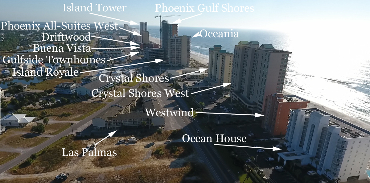
Starting East and working back toward the West, this lists condos by location: Island Tower, Phoenix All-Suites West, Driftwood, Buena Vista, Gulfside Townhomes, Phoenix Gulf Shores (Under Construction), Island Royale, Oceania, Crystal Shores, Crystal Shores West, Westwind, Ocean House I & II and Las Palmas sits on the North side of Beach Blvd in West Beach.
Far West Beach Area of downtown Gulf Shores Alabama
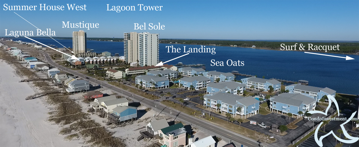
Mustique is the last high-rise condo in West Beach with Summer House West next door. Laguna Bella, Bel Sole, The Landing and Sea Oats is pictured and the Gulf Shores Surf & Racquet is located just outside the picture next door to Sea Oats;
The condos listed in the images above represent most condos on the Gulf of Mexico in Gulf Shores. There's a lot of condos listed for sale in Gulf Shores not included in the images above. We're in the process of including aerial images to include all condos in Gulf Shores. For now, check out our Gulf Shores AL condos for sale page; complete with revenue, recently SOLD real estate info, interactive maps, aerial imagery and more.